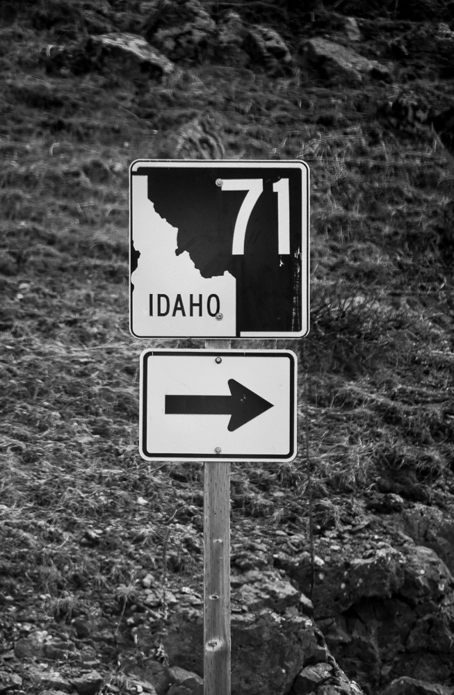
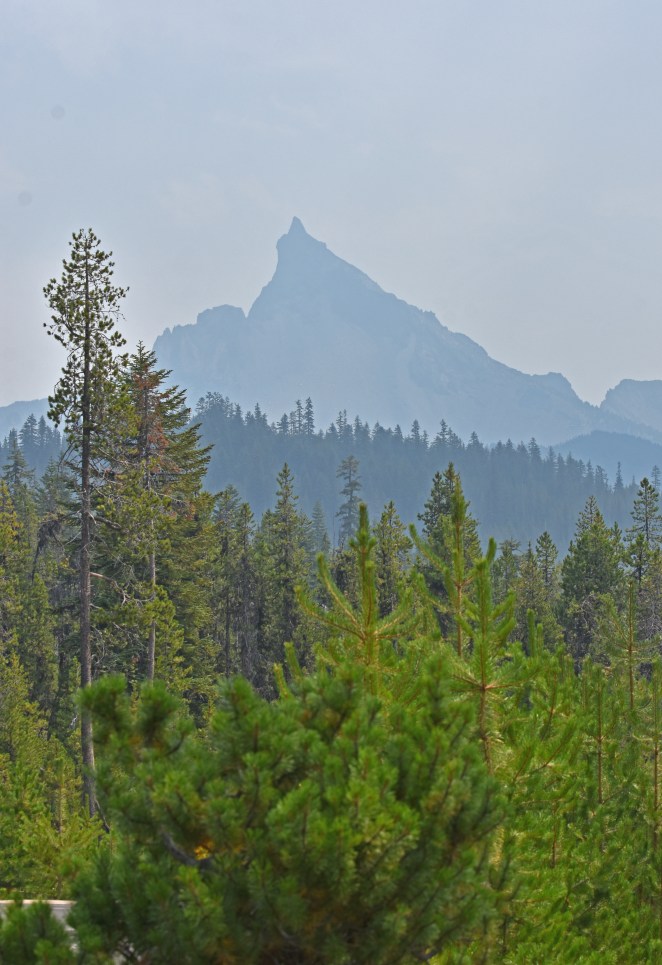
Late summer can be a difficult time in southwestern Idaho. The triple digit temperatures combined with the inevitable forest fire smoke make the air quality bad enough that cycling becomes the exercise equivalent to hanging out on the back porch smoking cigarettes (i.e. unhealthy). Fortunately, this year we had an option: Ride motorcycles…somewhere. John was in possession of a newly acquired 2017 Honda Africa Twin and he wanted to ride to visit his dad, Jack, in the beautiful central valley of California. Between the heat and the incredible smoke from the California forest fires, the direct route from Boise to Jack’s sounded like a pretty unpleasant ride, so we brainstormed and came up with a more circuitous route that would be more fun. Early on in the planning process, we decided that checking out the Redwoods in northern Cal was a goal. John added checking out the sequoias to the list, and a plan was formulated.
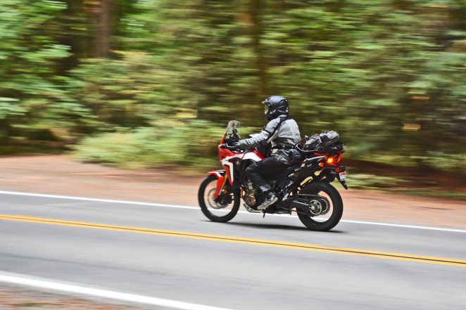
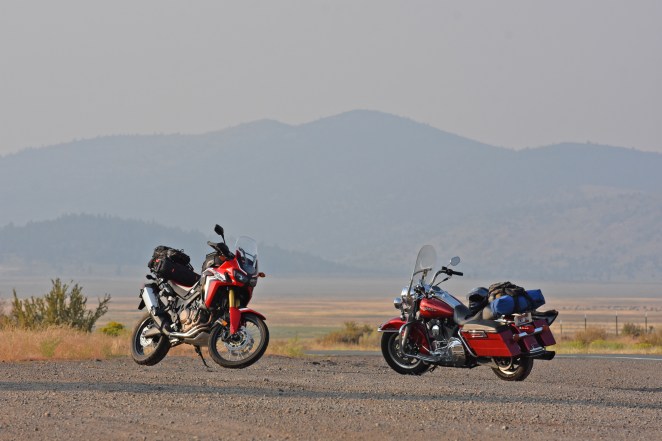
A key element of the plan was camping off the bikes. We both have done some backpacking so we have the necessary equipment to go light and move fast. Our motorcycles for this trip are very different: John rode his new 2017 CRF1000L Honda Africa Twin, I rode my 2004 FLHR Harley Davidson Road King. We both were very busy at work prior to leaving town so we kept the planning very general: head that way, sleep on the ground, see big trees, ride.
EQUIPMENT:
- 2017 CRF100L Africa Twin, stock. ~600 miles. Givi Tanklok tank bag, Kreiga tailbag. USB outlet on handlebars, RAM mount for GPS/Phone,
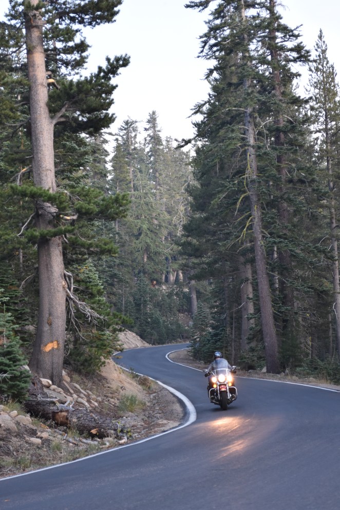
- 2004 FLHR Road King, D&D (I think) 2 into 1 pipe, otherwise stock. ~16,000 miles. Newish Michelin tires. USB outlet wired into the saddlebag.
Day 1 found us leaving Boise at rush hour in 100 degree heat in stop and go traffic. We both have Sena intercoms installed in our helmets so we could at least commiserate on the unpleasant experience. Soon enough though we were out of town and heading west on a lightly traveled two lane highway that leads us to the Oregon border. After a quick stop for food in Nyssa (where we spotted a Ferrari…very out of place), we were blasting down Oregon Hwy 20 to the west. As the miles piled on the temperature turned very pleasant and the clear night with the moon above made for some great riding. After a quick gas stop in Burns (and a layer addition) we blasted the last few miles to our campsite for the night, Chickahominy Reservoir. We pretty much had the place to ourselves and we had a pleasant night’s sleep, serenaded by a nearby pack of coyotes.

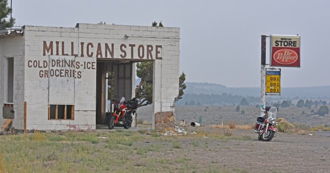
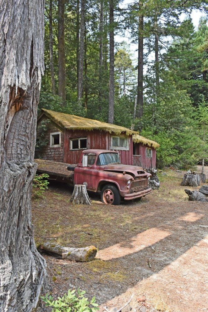
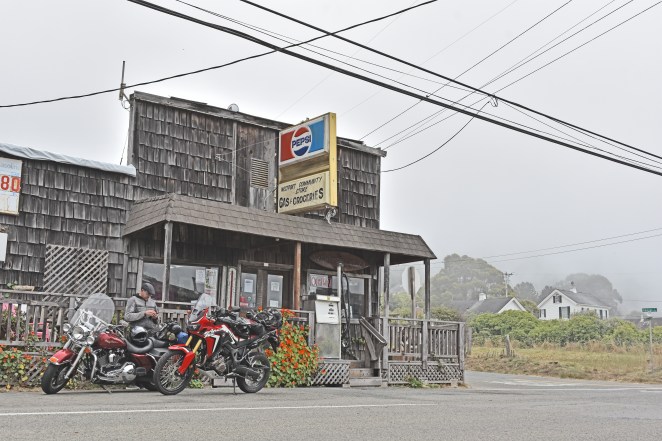
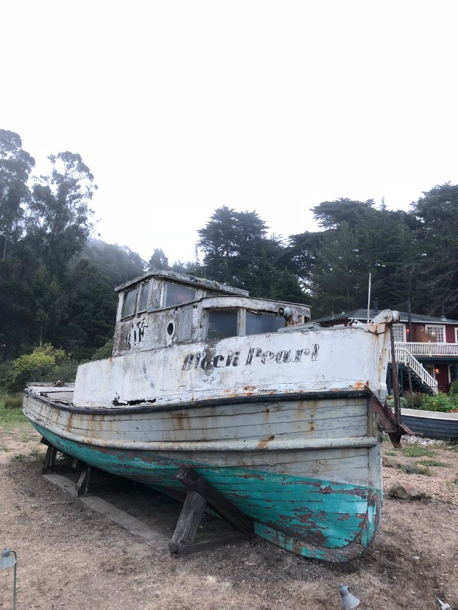
In the morning we packed up and hit the road, only stopping once on the way to Bend to check out an abandoned service station at Millican Or. Soon enough we were in Bend eating breakfast and plotting our next steps. An hour south on a busy Hwy 97 took us to Diamond Lake Junction where we the turned off onto Oregon Hwy 138 (aka the North Umpqua Hwy) which turned out to be a real treat for our motorcycles with minimal traffic, beautiful scenery, good smooth pavement and lots of turns. We stopped briefly at the Diamond Lake overlook where we were approached by the boldest chipmunks I have ever met. We were powerless to resist their entreaties and I ended up giving them most of my snack material. With lighter saddlebags we got back on the road which descended rapidly to the North Umqua River, which it followed to the small town of Glide, where it turned southwest towards Roseburg.
Just south of Roseburg we turned west onto Hwy 42 which took us into the coast range where the 95 degree weather began to cool as we passed along the Coquille River. Along the way we stopped to check out the historic Sandy Creek covered bridge. The bridge itself is well cared for, although apparently local miscreants couldn’t resist the urge to graffiti the newly painted historic structure. After a short break we were back on the motorcycles heading towards the coast with its beckoning cooler temperatures. In the town of Coquille we took a left onto Hwy 42S (aka the Coquille-Bandon Highway), already the temperature was falling as we rode this delightful stretch of road 15 miles or so to Bandon, where we joined the legendary Hwy 101 and got our first glimpse of the Pacific Ocean.

A much needed stop for dinner was made at the Bandon Brewing Company. A popular brewpub with indoor/outdoor seating located just off the highway in touristy part of Bandon. The smell of pizza wafting out of the restaurant drew us in. Unfortunately they were so busy that the wait staff felt compelled to warn us that the pizza oven was backed up due to high demand and we should order grilled items instead. Burgers it was. We ate our burgers, talked with a few locals, and John fielded questions from an interested tourist on his Africa Twin (this would be a reoccurring theme on our ride).
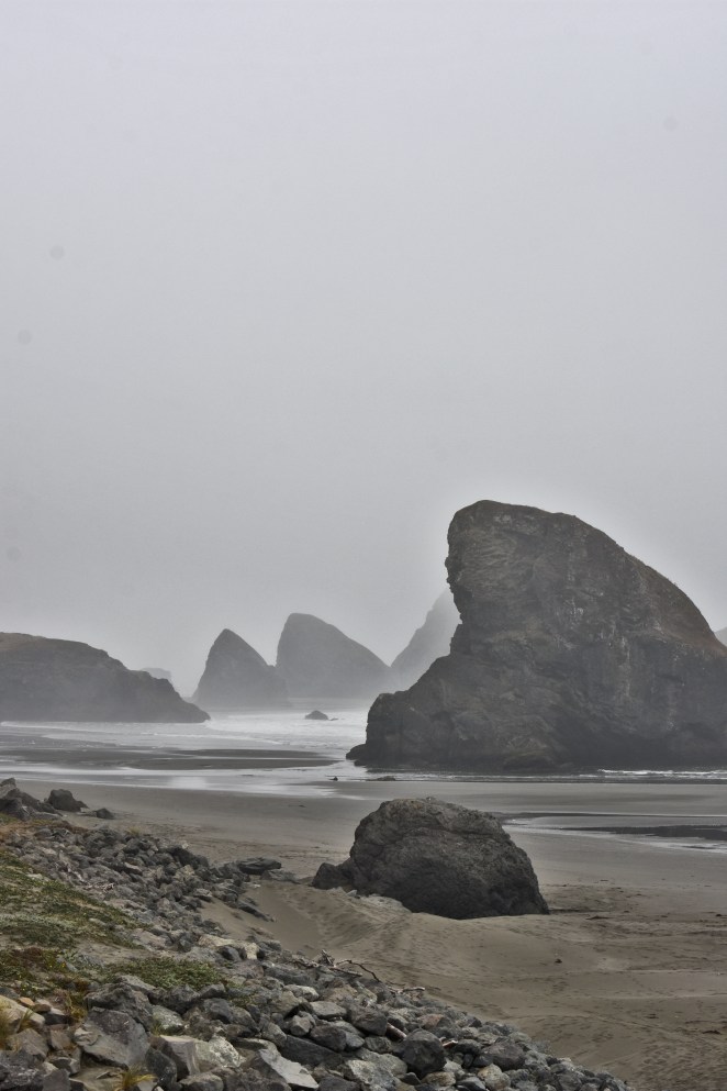
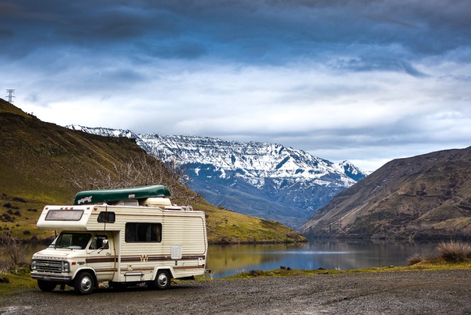
After dinner we headed off south down Hwy 101 towards our planned stop for the night, Humbug Mountain State Park. Quickly, things got dark and foggy and I began to feel the chill of the night air. It was a fantastic contrast to the almost unbearable heat of only 24 hours before when my air cooled motorcycle felt as if it might burst into flames from the heat as we were trying to escape Idaho in rush hour traffic. We rolled in to the campground at 830 pm (the sign at the entrance proclaimed “campground full”-which we ignored). The helpful campground host told us about two open campsites, and the first one we got to we immediately claimed. It wasn’t the best campsite, wedged between camper vans and RVs, but it was close to the beach, and I slept like a baby after the long ride. Waking at dawn, I was pleased to discover that this park offered free showers-which I immediately took advantage of. A misty morning walk on the beach was very satisfying and made hopping back on the bike much nicer. Breakfast awaited us 22 miles to the south in Gold Beach.
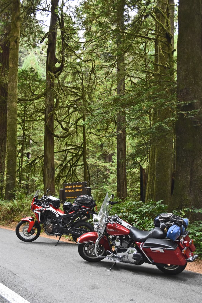
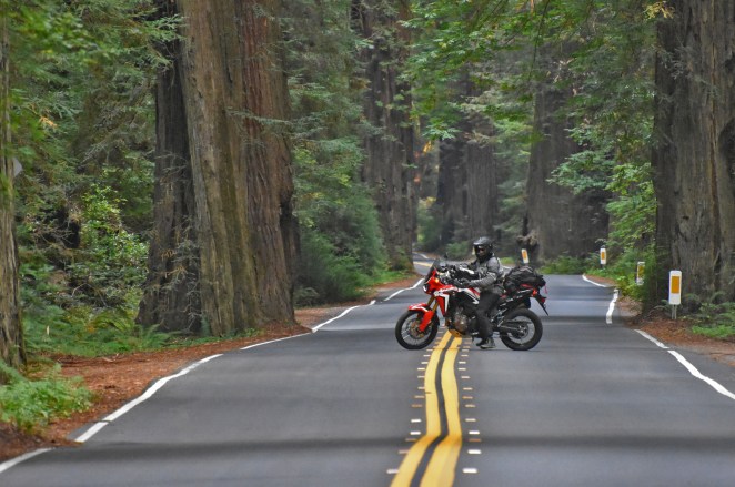
After breakfast (and a gas stop) we were off down Hwy 101 to California. At the intersection of Hwy 197 we took a left and rode towards our first opportunity to see the Redwoods. Our trip into Jedidiah Smith Redwoods State Park offered some amazing riding, a few giant trees and a few choice photo ops. We didn’t stay long though, John knew of better tree viewing opportunities down the coast. He was right, another 30 miles or so of riding took us to Prairie Creek Redwoods State Park. This was more like it, a really cool ride through the park down a shaded lane took us to a little rest stop with some magnificent trees nearby. While in the parking lot I spied two fellow riders obviously on a journey of their own so I walked over and said hi. They turned out to be two nurses from Canada on a 21 day, 7000 mile road trip down the coast and eventually to southern Utah, before heading back to Calgary. These ladies were full of helpful tips, bubbly enthusiasm, and general good vibes. I came away from our encounter feeling ready to put down some miles, which was good, because we had some miles to do… Our next stop was 80 miles to the south, we cruised through Eureka (which didn’t make a very positive impression on me) where we got burritos and gas and then wicked it up to 70 plus until we got to the entrance of The Avenue of The Giants.
The Avenue of the Giants was what I had in mind when we first talked about going to the redwood trees. In a word, amazing. The Avenue is a nice undulating two lane road that winds through groves of giant redwood trees, each more spectacular than the last. Every once in a while you come across an isolated house or two but then you are back into the trees. We found a place to stay the night at Hidden Springs Campground, set up our tent and rode back to the last civilization we had seen (a bar) to procure supplies. At Meyers Flat we bought a few beers from the bar for the campsite and while packing our provisions were approached by a fellow motorcycle traveler who was drawn to the shiny Africa Twin. He announced that he had ridden his Kawasaki ZX-10R up from southern California at some point in the previous few days and proudly told us his sum total of riding gear consisted of “a wifebeater and a hoodie” (plus a helmet of course -this is California after all). He told us that he slept in rest stops “back in the corner where the trucks are” on his trip. Minimalist moto camping at its best! Back at camp we had an early night and slept amongst the big(ish) trees. In the morning we woke early and had a quick ride through another amazing grove of giant redwoods and found breakfast 88 miles or so down the road in Miranda. While I enjoyed coffee and eggs benedict on the porch of the Avenue café we struck up a conversation with a fellow traveler who was riding her bicycle south to San Diego. She had just graduated from college and took a few months to ride before things got serious again. Cool. I wish I could do that. I couldn’t help but compare her travel experience to that of the guy at the bar the night before. Both adventures, both a little risky, both memorable. After breakfast, there was a last short stretch of the Avenue of the Giants to enjoy. We made sure to stop and do some photography since it was such a magnificent location.
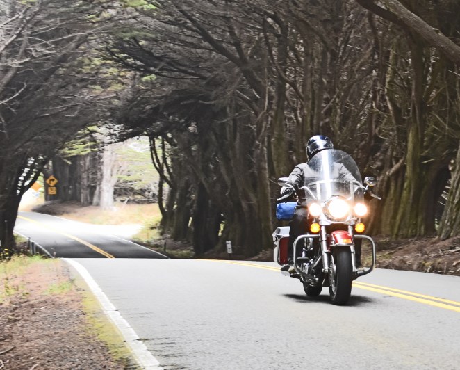
After leaving the road of big trees we had 30 miles of crowded Hwy 101 to do before we turned off on Hwy 1 near Leggett. Hwy 1 is a completely different experience from 101, much lower traffic, narrow, tight, twisty…awesome. We would stay on 1 as much as we could on this trip and it was wonderful. In 20 miles we rode through sunny south facing mountainsides, shady moss covered forests, and down to the foggy seaside. Not only was the scenery varied but the temperature seemed like it varied by as much as 20 degrees. After a photo stop or two, we took a break in the tiny town of Westport. We bought snacks and sat on the porch of the community store and chatted with another bicycle traveler. He was a motorcyclist as well and told us we would love the next stretch of road. He was right.
The next stretch of road was twisty and scenic (what you could see through the thick fog anyway). We did some more photography and found ourselves following a train of 8 or 10 touring Harley Davidsons. The rider at the tail end of that group made us both a little nervous so we pulled off and let them get comfortably ahead. Lunch was had at the North Coast Brewing Taproom in Fort Bragg. We had a nice lunch while we looked over maps and tried to guess at where we would spend the night (spoiler alert-none of our guesses were correct). Nice touristy town Fort Bragg but we had miles to cover…
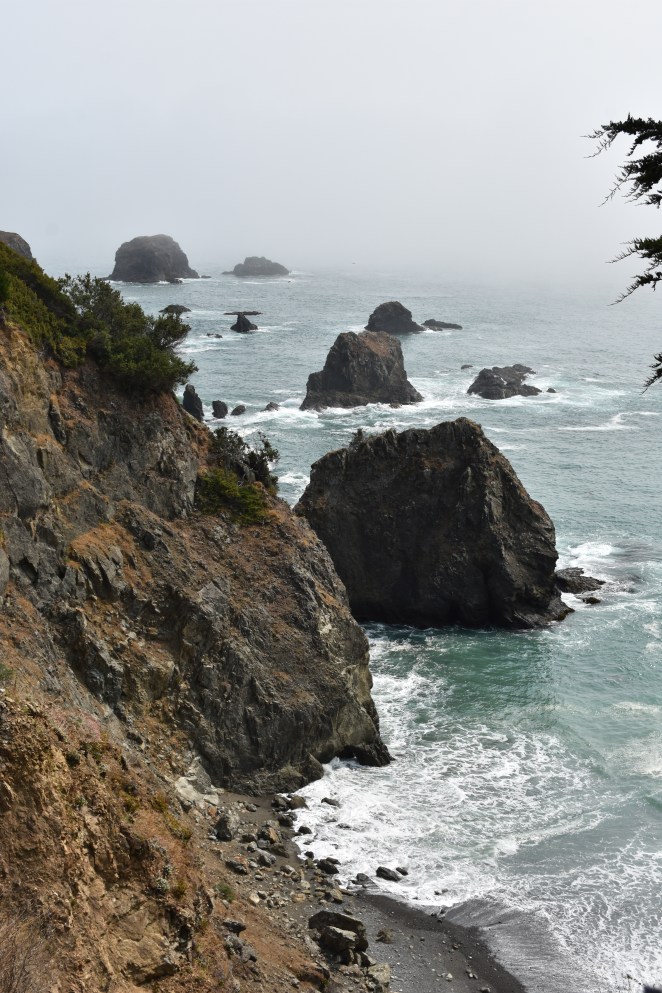
The next stretch of road was pretty great. The sun actually came out a few times and revealed the ocean crashing on the rocks to our right. We rode miles of beautiful twisty roads, most of the time only sharing it with bicyclists. As a bicyclist myself I tried to minimize my intrusion on their experience and mostly I succeeded, I think. Anyway it was great and I loved every second of it. We stopped a few times along the way for the inevitable pictures and just to get off and enjoy the sea air-which we knew we wouldn’t be smelling much longer. Fort Ross looked pretty cool but we were too cheap to fork over 8 bucks apiece to go inside, fortunately you can get a pretty view of it from the hwy. It was around 5 pm when we made it to Bodega Bay (where we got gas/coffee/monster energy). It was getting time to really think about where we were going to end up sleeping. There were no obvious answers so we kept riding.
Passing through some nice little towns, this was a great part of the ride. I enquired at a little hotel whether they had a room for the night, denied we kept on riding south. As the light faded the fog started to set in, slowly at first but eventually we found ourselves riding in a full-on fogbank. My vented motorcycle gear that was barely cool enough 48 hours before became way too cool fast. Also, our intercom systems both ran out of power and shut off. A hasty roadside conference resulted in me donning my Walmart Frogg Toggs and the two of us attaching backup power cells to our intercoms-(we would need them in the coming hours).
The next few hours were, in a word: surreal. The water droplets from the dense fog sparkled like a thousand diamonds in our headlights. Visibility was maybe 50 feet. The occasional auto traffic would momentarily blind us with their headlights as they passed. We twisted along the waterfront, passing the occasional house or closed business. After what seemed like an eternity we left the waterfront and climbed a very steep, twisty road that took us under trees so laden with moisture from the fog that when you passed underneath them it appeared to be raining. Then, all of a sudden, we were out of the fog in a town, Almonte to be exact. Stopping for gas we huddled up in our water covered gear and high fived like we passed a trial by fire.
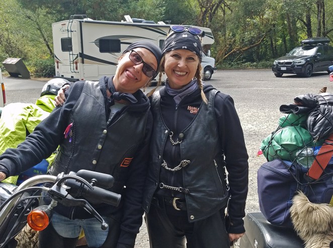
It was decision time. We still didn’t have a real plan for our night’s destination and it was 10 pm on a Friday night, just north of San Francisco. We were both tired from 14 hours of riding and we knew we had to be at Jack’s house Saturday but we had options on how and when to get there. I was of a mind to find a hotel and a warm shower, John still was interested in camping on the beach down near Santa Cruz. In the end we decided to just hit the highway and white-knuckle it the two hours or so to Jack’s home in Hilmar. That meant getting onto 101 for a few miles and then riding over the Richmond Bridge before riding a web of freeways on our way east. John was justifiably nervous to ride on the freeway on his new bike (he had never ridden any appreciable amount of time on one before this trip) but I assured him we would ride as a unit using our intercoms for coordination and we would be fine. We accelerated down the onramp and immediately found ourselves in the controlled chaos that is the California freeway system. For the most part it was a pretty uneventful ride that saw us speed through the night, experiencing rapid temperature changes (50 degrees at the coast, 85 degrees in the Central Valley), strange odors (primarily cow manure and marijuana smoke), and the occasionally bizarre behavior of our fellow drivers (possibly related to smell #2 above). As with any authentic California highway experience we had some stop and go followed by clipping along well in excess of the speed limit trying to stay up with traffic. With relief, we pulled into Jack and Becca’s driveway at 11:45pm. It had been an amazing day of riding, and we were only halfway through our trip.
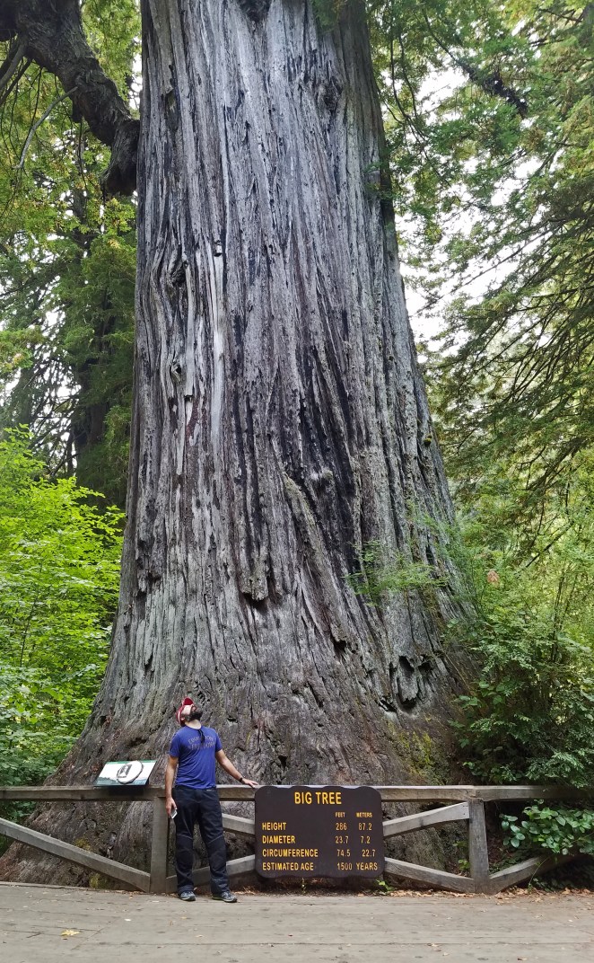
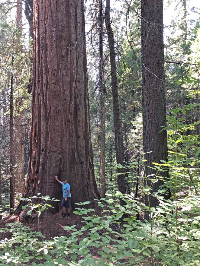
After a much needed 36 hours of rest with John’s family we hopped back on the bikes Sunday morning. Our goal was to get out of the hot central valley up into the foothills and eventually, into the Sierras where we would check out California’s other giant trees, the Sequoia. After a warm, fun ride along some rolling, smooth pavement, we arrived at Calaveras Big Trees State Park. We paid our admission fee (of course, a motorcycle pays the same price as a loaded suburban, because that just makes sense) and took a stroll through the visitors center. The maps and displays inside are quite informative and helped us locate a spot to take a stroll and take in the big trees. I learned that there two types of Redwood trees native to California, the coast Redwood (that we had just enjoyed in our ride through the Avenue of the Giants), and the giant Sequoia that are scattered around the western slope of the Sierra Nevada. It looked like the Sough Grove would be interesting so we headed that way. The park is quite large and the roads are excellent so it was a fun ride to the grove where we parked the bikes and stripped off our riding gear for a hike. It was a good break from the bikes, plus some much needed exercise. After drinking in the scenery, feeling tiny compared to a giant, ancient tree, and generally enjoying the park, it was time to hit the road again. We had only gone 100 miles or so since starting and we needed to cover some more distance before we stopped for the night.
Out of the park, we turned back onto California Hwy 4 (AKA the Alpine State Highway) and climbed to the east further into the mountains. Traffic noticeably lessened as we moved away from the populated valley. We passed Bear Valley ski area and without warning the road went from a standard 2-lane highway to something more like a campground road, paved but quite narrow, maybe 1.5 lanes wide. Confused, we pulled over at Lake Alpine and consulted the maps. While we were getting our bearings I talked with a guy in a pickup who was pretty eager for conversation. Quickly, he started telling me about the “giants” that are well represented in the archaeological record (according to him, anyway) but that “they” don’t want us to know about it… OK, whatever you say man.
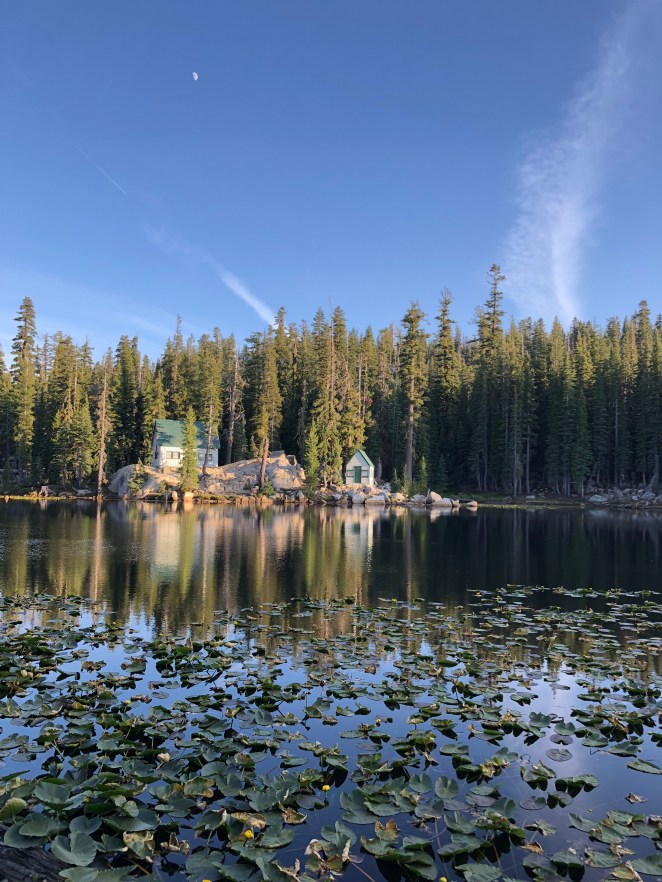
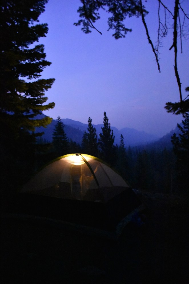
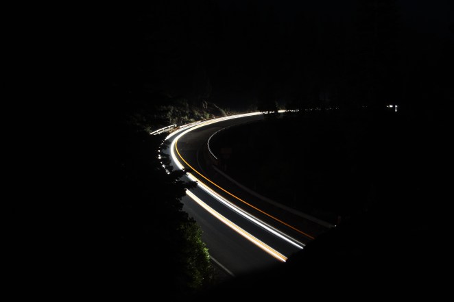
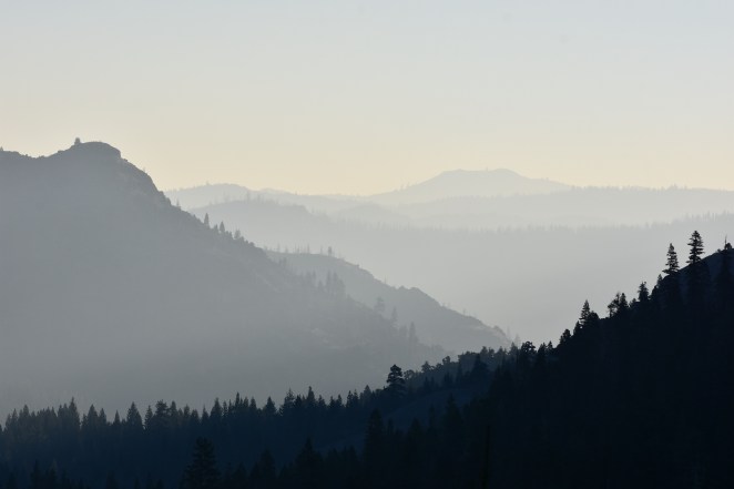
Since it appeared that we were headed the correct way so we continued east. The road wound up and down through some amazing country, one minute climbing 10 mph switchbacks, the next passing amazing mountain lakes located at 8,000 feet above sea level. At one point we stopped to check out the view and watch the smoke from a nearby forest fire. It was far enough away to not be too concerning… As the day turned to night we started to look for a good campsite. Just when we were starting to think about a side of the road kind of spot, we chanced upon Silver Creek campground. The campground was virtually empty (just one other camper on the other side of the “highway” from us. We cruised through and picked out the best spot which had a wonderful view to the east overlooking the road as it descended the mountain. It was a fantastic night, John did some really cool long aperture photography and we laid on our backs on a basalt boulder and swapped stories while drinking warm beer. At some point that night the wind direction shifted and the smoke from the nearby fire came into camp so thickly that I woke in a panic thinking we were going to have to flee. After a while I convinced myself that we were safe(ish) and I went back to a fitful sleep. In the morning we were greeted by a Smokey sunrise and shortly afterwards, by the other camper, the camp host. He was a nice older guy who hung out with us for a while (and collected the $18 fee, of course). Apparently this campground was usually packed that time of year but the fires were keeping people away. Understandable.
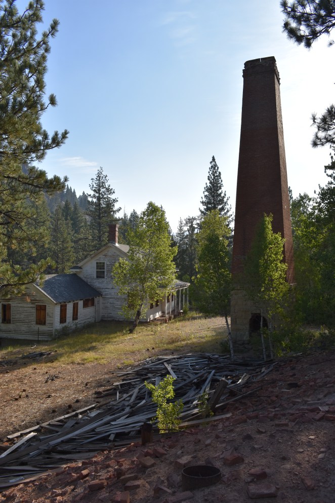
Back on the road we descended the mountain and stopped for a little exploring at an abandoned brick factory (really, it was just a smokestack, a really cool 19th century house, and a big pile of abandoned bricks). Coffee was on my mind, however, and we sped away to the next town on our maps, Markleeville. We had our choice of two establishments for breakfast, and we picked the wrong one. The less said the better…
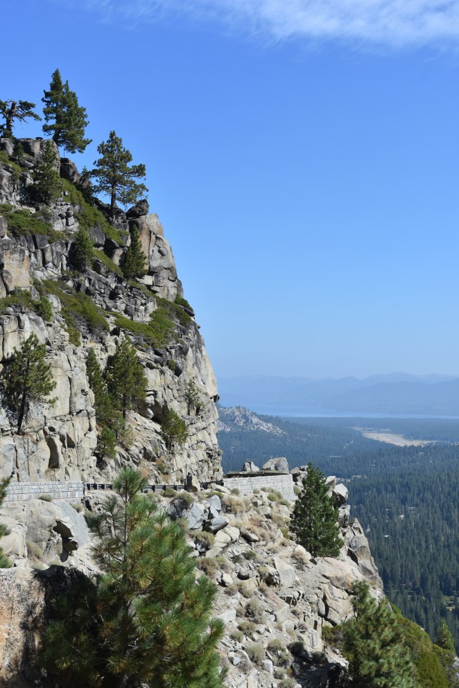
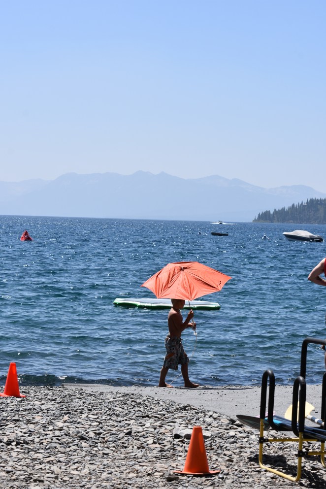
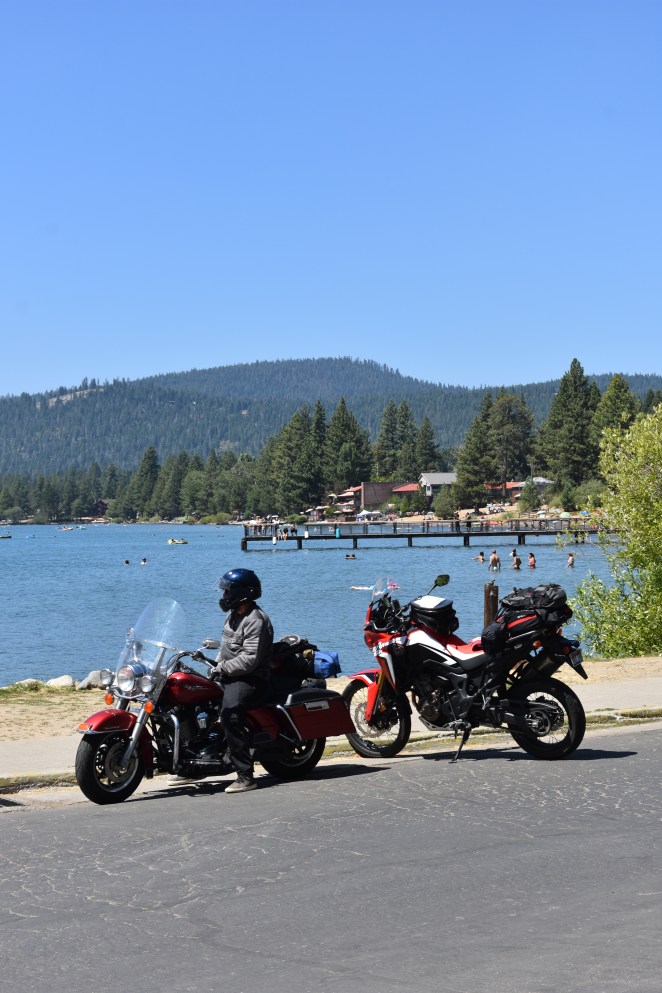
With a “meal” in our bellies and a fresh load for 91 octane, we departed the pleasant little town of Markleeville to the north. The next stop was Lake Tahoe. The ride around the western side of the lake was slow (due to traffic) but fantastically scenic. We rode around the lake and stopped at the northern end where we got off the bikes, drank more coffee (I did anyway), and soaked in the vibe of the place. The little coffee shop we found had a great view of the lake and a demo skateboard so pretty much win, win for us. After a half hour break or so we hit the road and climbed out of the valley to the north. The traffic was fairly heavy at first but quickly thinned out as we left the $$$$ of Lake Tahoe. Back on the road it was a fine ride for a bit and lunchtime found us at a literal crossroads in Sierraville, CA. Stopping for a meal, we ambled into the Fork & Horn restaurant where we were both treated to a great lunch. Our server, a young mother whose name escapes me, engaged us in lively conversation and the overall feel of the place was that of a town where everyone knows each other, and life is pretty much the same it has been for a hundred years. It was with some reluctance that we hopped back on our motorcycles and left town on our journey.
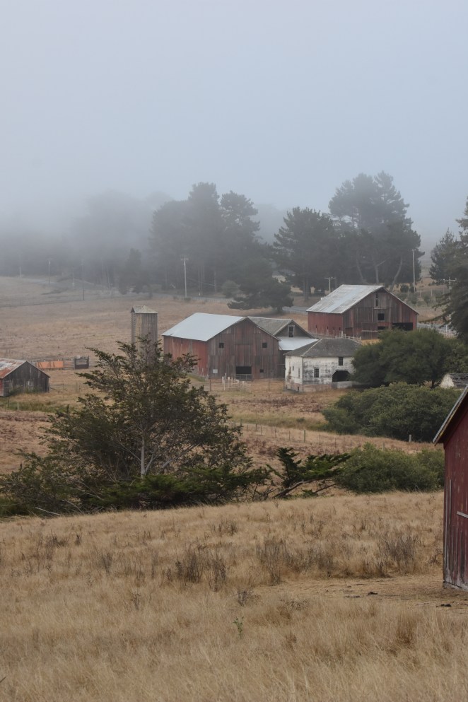
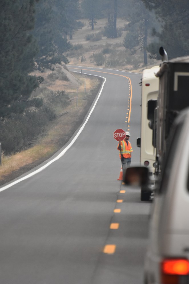
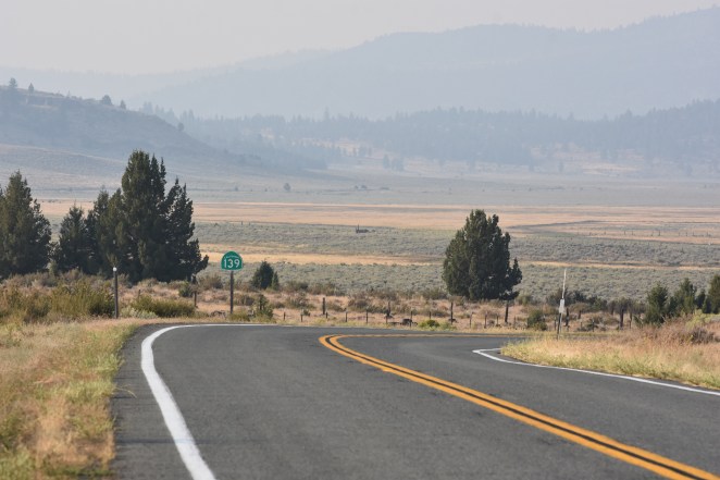
Just north of town we were reminded of the danger that surrounds us when travelling on motorcycles when John was very nearly blown off the road by a passing semi-truck. That would have sucked. With that little reality check we continued north, passing through small towns that had clearly seen their heyday in the 60s-70s as evidenced by the dilapidated motels, boarded up bait stores, and abandoned gas stations. At Lake Almandor we stopped along the east shore for a break to stretch our legs. So far so good, it had been a great ride so far. After a rest we hopped back on the road and sped east towards Susanville. In Susanville, we stopped for gas and I shoved a couple of cold beers into my saddlebags, in the 90 degree heat, they wouldn’t stay cold long… Climbing out of town to the north on Hwy 139 we were treated to more spectacular views of the sparsely populated country. After an hour or so we pulled over to drink the (now merely cool) beers. The beauty and low population of the area was on full display from our roadside stop and our destination for the night was still in question. Both John and I were of the opinion that we should just “see where we end up” so with that philosophy in mind we headed off through the late afternoon sunlight to the north. Somewhere north of Adin, CA we encountered another forest fire. This time we were stopped by a roadblock and only allowed through with the escort of a pilot car. The smoke was thick and in places we spied open flames to the north where the fire still burned. Even though we were getting tired, the thought of another smoke filled night was enough to drive us on. Turning east near the Oregon border we made our way to Alturas, where we refueled (and picked up some foodstuffs) and John, consulting his gps, picked a campground within range for the night.
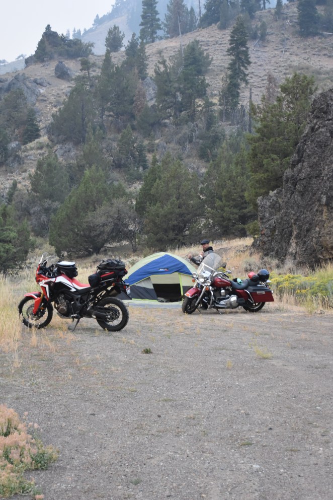
30 minutes to the north of Alturas was (according to the paper map and google) a campground that would be perfect for us so we ventured out of town looking for our spot. A few miles from the location on the map John asked me to lead as he hadn’t brought his clear lenses for his glasses and it was quite dark already. Within a mile of taking over the lead I encountered a family of deer around a blind corner. Fortunately I was moving pretty slow and it just served to warn me to keep things mellow. The campground, however, was nowhere to be found. Not in the location on the map, not anywhere. We ranged up and down the mountainside looking for a sign or gate or anything, but no luck. It was gone, vanished (more likely decommissioned by a cash strapped ranger district). Plan B, pull over and find a spot. I had seen an old road bed at the summit of the small mountain range we were on and suggested that it might work. Sure enough, we found a flat spot suitable for our tent and settled in for the night. Once again a warm beer and some jerky sufficed to keep us happy as we watched the rare car or bus drive by. After seeing enough random big old busses I put two and two together and realized that we were on a backroad route to Burning Man. It added a little color to our own journey. Maybe next year, burning man, maybe next year…
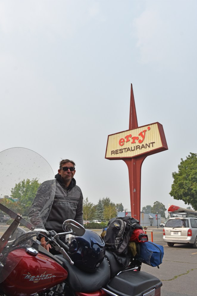
In the morning we packed up and headed north to the border of Oregon. There we found Lakeview, and in that town we found a wonderful breakfast, easily my favorite of the trip, at “erry’s” (apparently the “J” fell off the sign, both sides of the sign…). With a full load of pancakes and sausage we found a gas station where we had chance encounter with two BMW rides fresh from a trip to Canada. “there are 500 fires burning up there, even worse than down here” they told us. We swapped stories of the road for a few minutes and then left ourselves, anxious to make our way home now that it was within striking distance.


")
")


")
")


")
")

")
")
")
")
")
")
")
")
")
")
")
")
")
")
")
")
")
")
")
")
")
")
")
")
")
")
")
")
")
")
")
")
")